Custom 3D Wood Maps from Your Strava, Garmin, or Ride With GPS Activity
Transform your cycling ride or event route into handcrafted 3D wood art – laser-cut, framed, and shipped worldwide. Just upload your GPX file from Strava, RideWithGPS, or Garmin
Layer by Layer: Turning Data Into Art
-
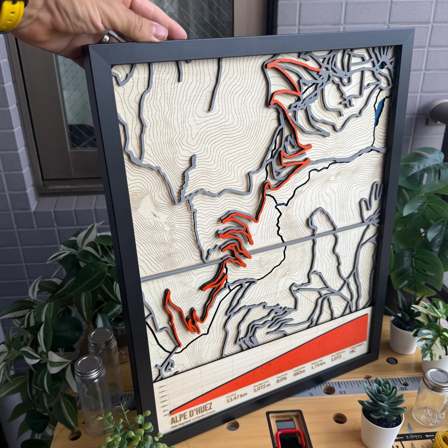
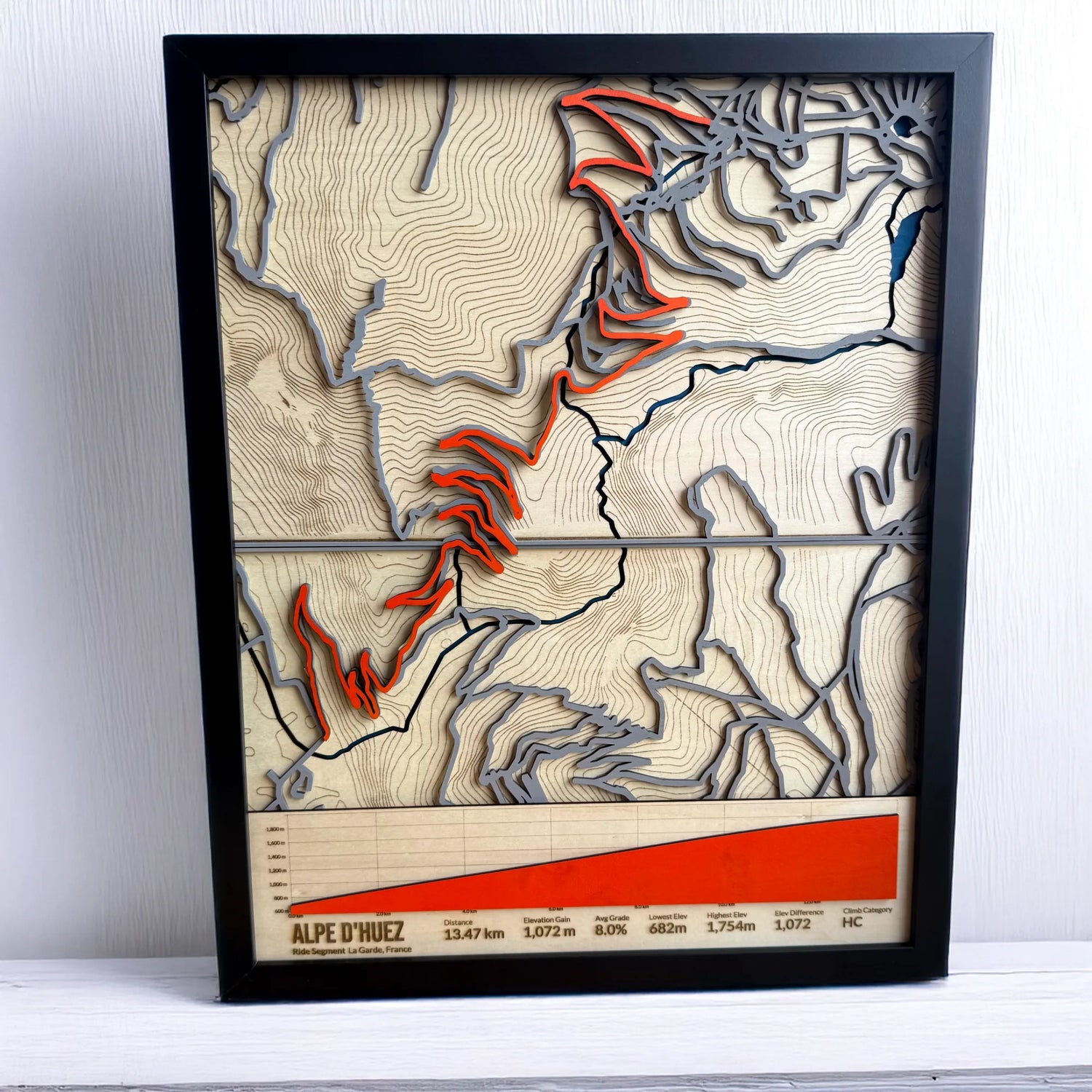
Each custom map is handcrafted from layered, laser-cut wood and finished with painted details, using your submitted GPX file from Strava, Garmin, or RideWithGPS. From water features and road networks to elevation contours and ride stats, every element is precision-crafted to reflect your real-world cycling effort.
-
Go ride it!
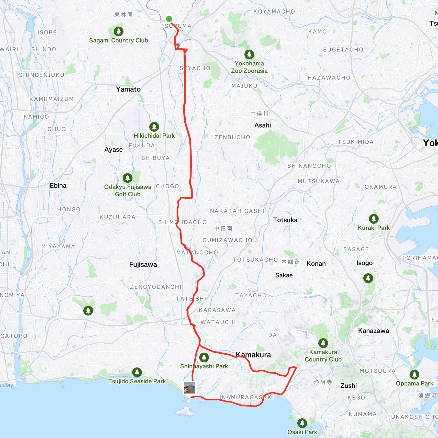
Start with your favorite route—whether it’s a daily loop, milestone ride, or epic tour. Upload your GPX file to turn real-world effort into precision-crafted wood art.
-
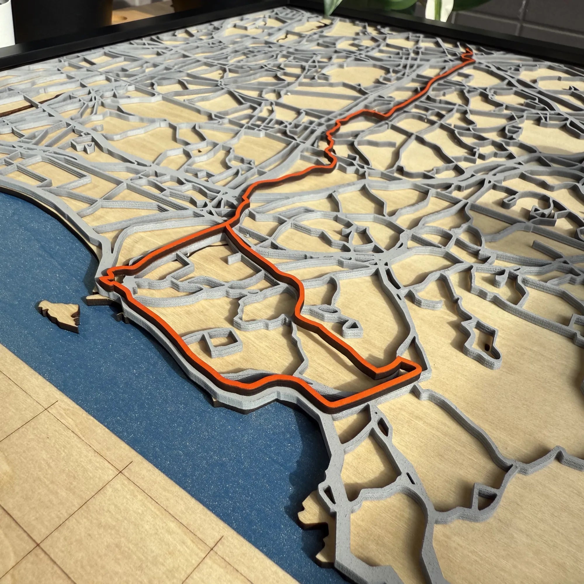
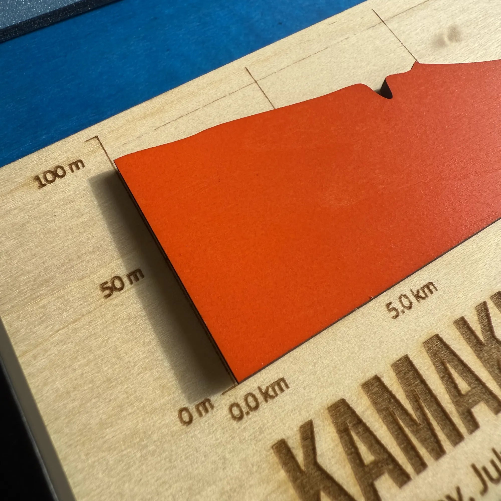
Activity Layer
Your uploaded GPX Activity is precision-cut from wood, painted bold orange, and placed above the road layer. This raised element makes your ride the visual focus of the entire piece—clean, crisp, and unmistakably yours.
-
Data layer
Select which ride statistics to engrave: distance, elevation gain, duration, power, and more. Add the Activity or Event date, choose ft/mi or m/km.
-
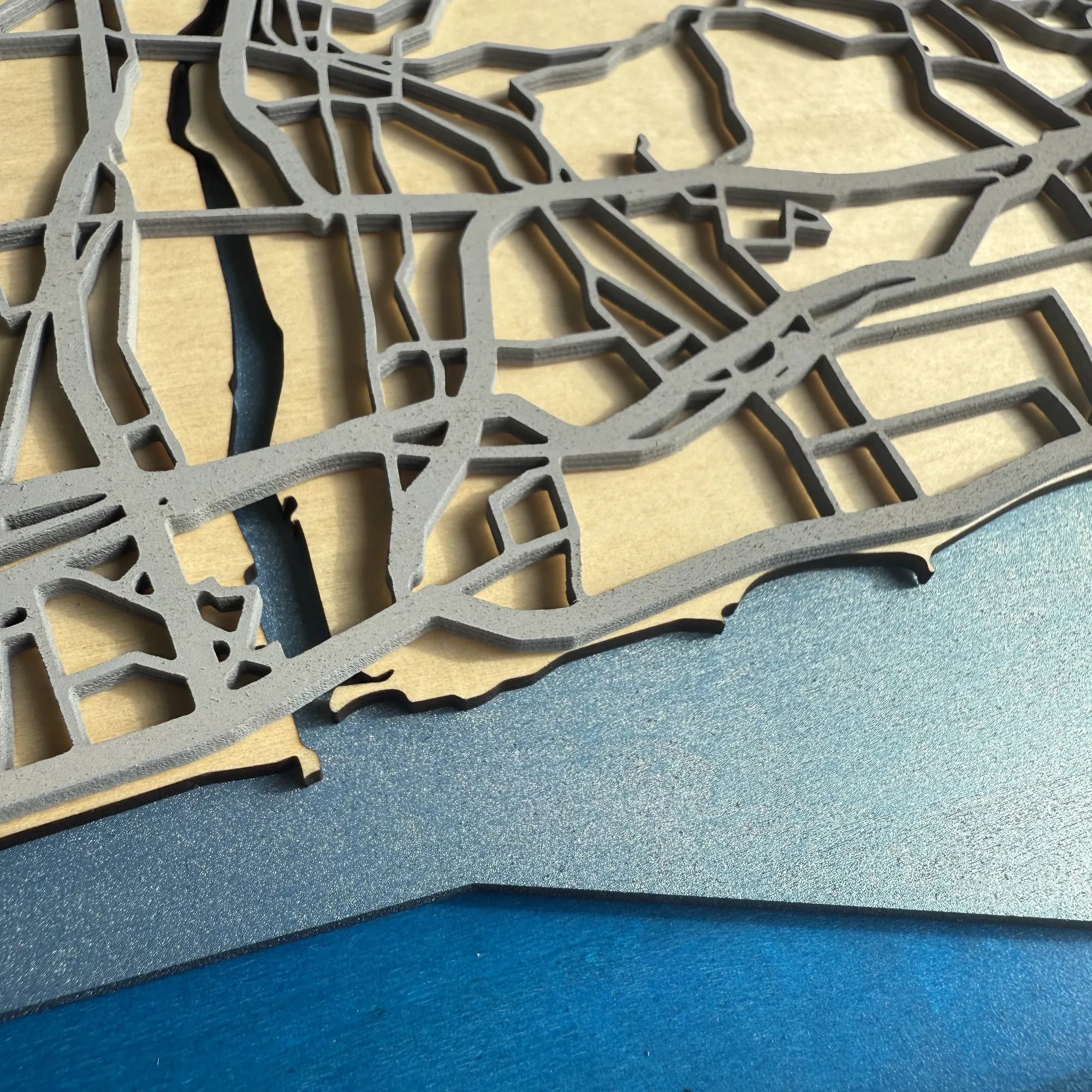
Road layer
Laser-cut roadways and paths are cut from painted basewood, carefully mapped from your route’s geography and scaled for clarity and accuracy. This layer helps define the structure of your ride within the broader landscape.
-
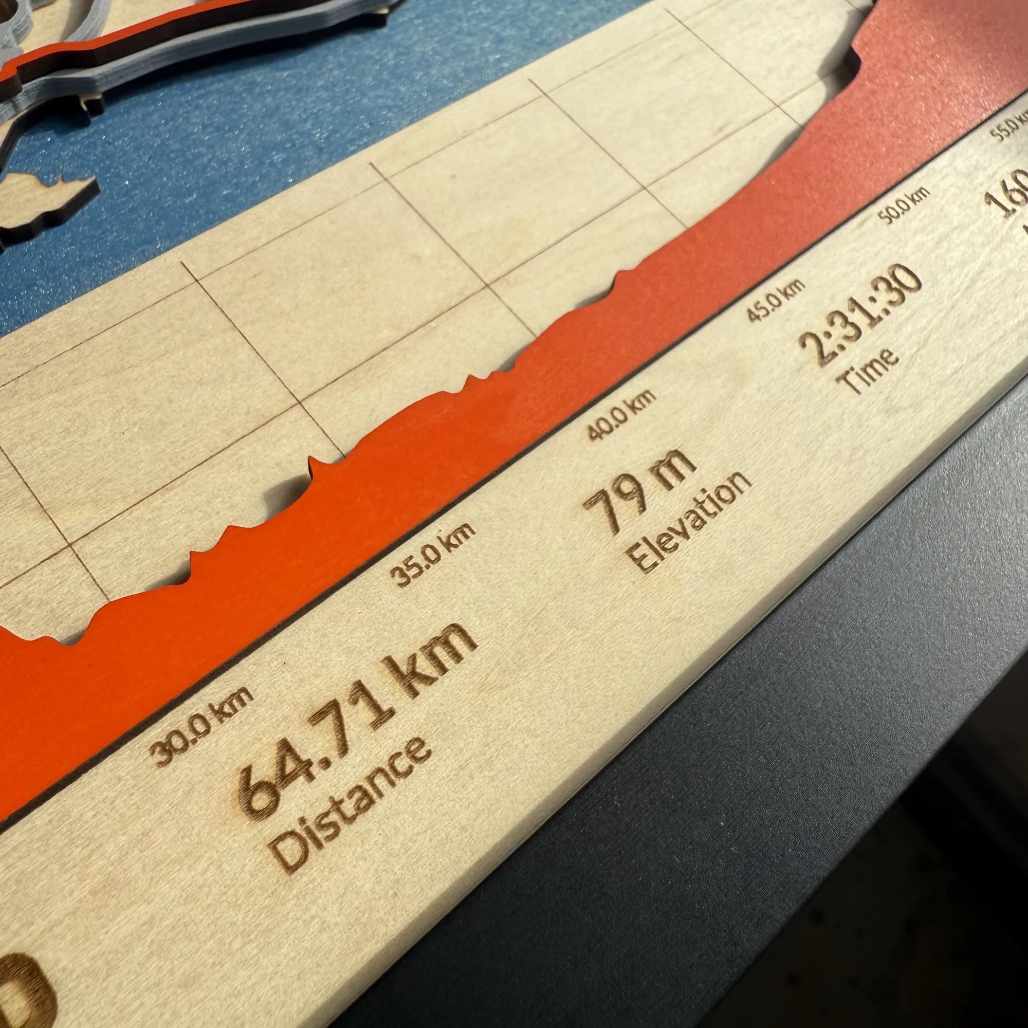
Elevation Chart
Your ride’s elevation profile is converted into a sculptural bar chart, laser-cut wood painted orange and placed onto the final layer - a bold, data-rich highlight of your 3D map that includes the distance and height.
-
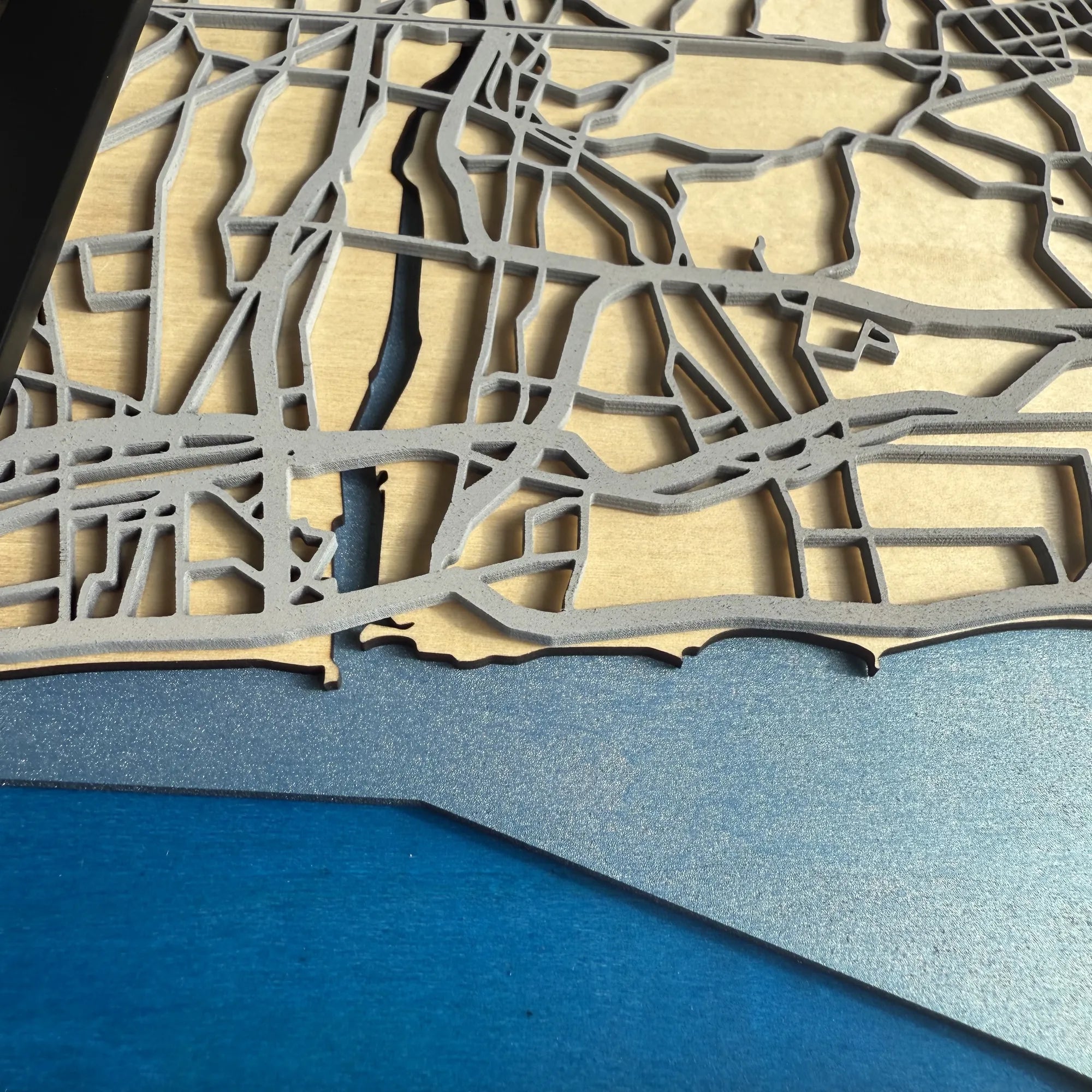
Water layer
Oceans, rivers, and lakes are laser-cut and layered using bathymetric data. Different water depths are represented by varying shades of blue, adding visual depth and realism to the map’s aquatic features.
-
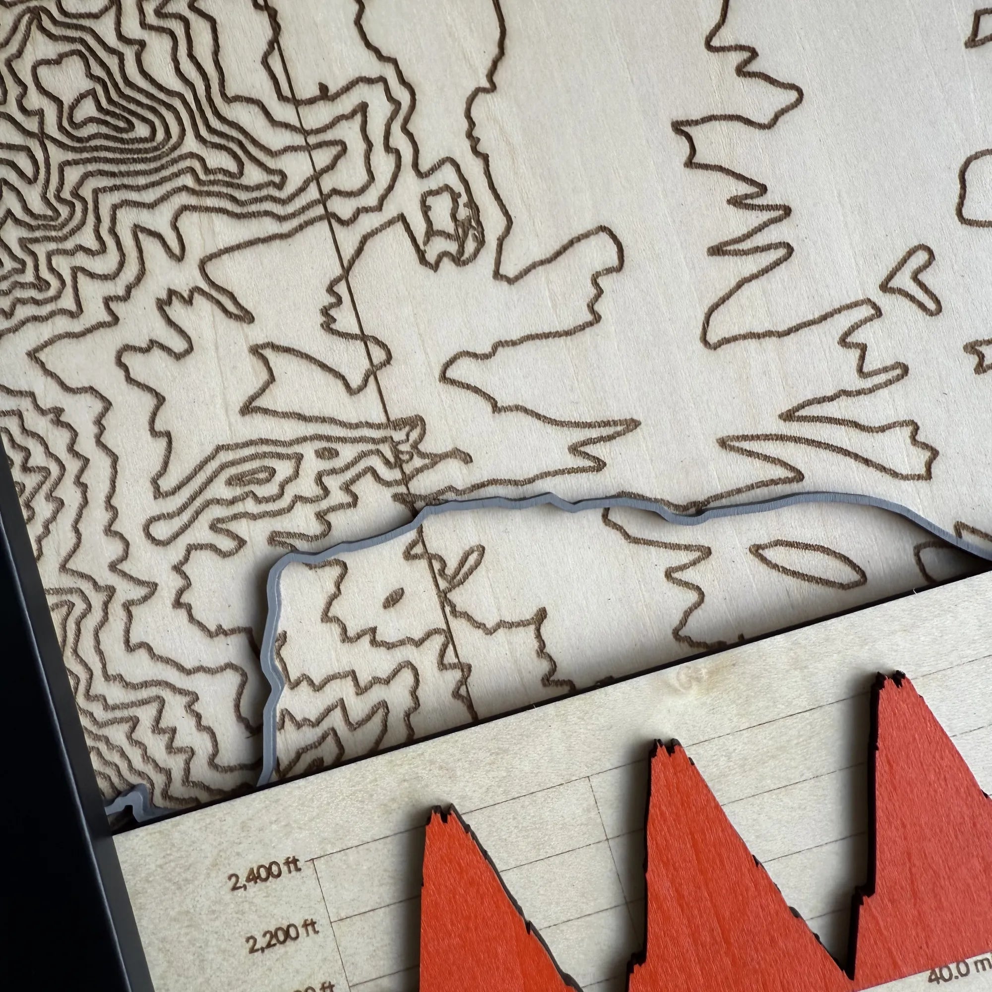
Contour layer
Topographic elevation contours are engraved directly into natural basewood using digital terrain data. These lines add a sense of realism and geographic context to the route.
-
Framing & Finish
Each map is coated in matte silicone lacquer to protect the surface and enhance the wood’s texture. Choose from black, white, or red fibreboard frames, all ready to hang with a pre-installed sawtooth hook. Your map arrives framed and ready for display.
-
Made in Japan by Mr. Tim
Every map is handcrafted by Mr. Tim, a passionate cyclist and designer based in Kanagawa, Japan. From GPX data to final assembly, each detail reflects a love of sport, craftsmanship, and precision laser work.


Please note:
The level of detail in each map depends on the scale and area covered by your activity. Longer or wider routes may show less intricate features, while shorter routes allow for greater detail.
We continually refine our designs — from materials and paint techniques to layering and finish. Each map is made from natural wood and handcrafted individually, so no two pieces are exactly alike. Variations in grain, texture, and finish make every artwork truly one of a kind.
You’ll receive a visual mockup before work begins, giving you confidence the piece will be exactly right — and a gift your recipient will love.
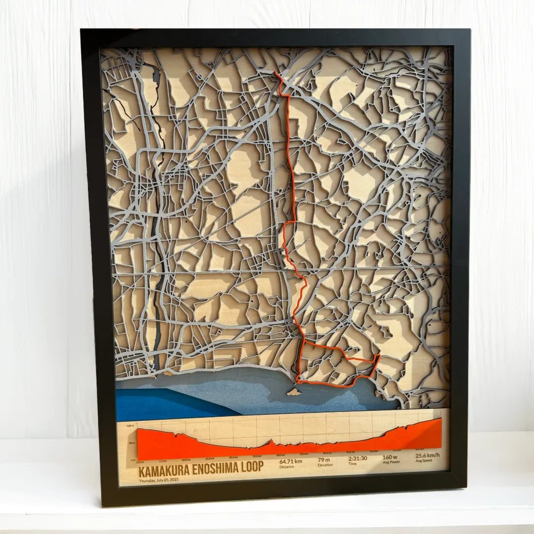
Machida to Kamakura to Enoshima – Custom Cycling Route Map in 3D Wood
Handcrafted from layered, laser-cut wood using GPX data from Strava, this map captures one of my favourite coastal loops in Japan.
Cycling Route Maps – Buy Now
Choose from handcrafted 3D maps made from your own GPX ride data, or select a ready-made design of world-famous cycling routes.
Custom 3D Cycling Map
Personalized GPX Wood Map from Strava, Ride with GPS, or Garmin | Handmade in Japan | Unique Gift for Cyclists
FAQ
Collapsible content
Can I see a preview of my map before I purchase?
You’ll receive a visual mockup for your approval before work begins, giving you confidence the piece will be exactly right — and a gift your recipient will love.
Can I request a map from outside Japan?
Yes. I'm from the UK and now live and cycle in Japan, so example maps feature Japanese terrain and courses that I have ridden, I’m happy to create maps from anywhere in the world - just provide your GPX data and I’ll take care of the rest.
What file format do you need?
I work with .GPX files, which can be easily exported from Strava, Ride With GPS, Garmin and most other cycling apps. No special formatting is needed—just the raw route file. If you’re unsure how to export, I can help guide you.
Can I include more than one route on the same map?
Yes! See Customer Showcase examples.
Can I request a different size?
Yes! We now offer the following standard sizes:
- 30 × 40 cm (11.8" × 15.7")
- 40 × 50 cm (15.7" × 19.7")
- 50 × 70 cm (19.7" × 27.5")
These sizes are carefully chosen to balance detail, scale, and visual impact.
Looking for something larger or tailored for a unique space? We welcome custom size requests — ideal for cycling stores, brand showrooms, clubhouses, or event displays.
Contact us to discuss bespoke dimensions or commercial commissions or view our Frames Guide for additional sizes in stock.
Can I request a custom color for the route and elevation chart?
Yes. The default color for the route and elevation chart is orange, chosen for its bold visibility and strong contrast against the wood.
If you prefer a different color, just ask.
How is the artwork packaged and shipped?
Each map is carefully protected with multiple layers of bubble wrap and cardboard, then packed in a custom-made, double-layered cardboard box. All orders include tracking, with worldwide shipping available.
USA Customers – September 2025 Tariffs
All custom wood map orders are shipped with tariffs and taxes fully prepaid. This means the price you see already includes everything—there will be no extra charges on delivery.
Trusted by Customers – 5-Star Reviews


Let customers speak for us

Love it!

My fiancé’s new cycling map is absolutely gorgeous and Mr. Tim really made this experience a 10/10 from start to finish. He communicated with me quickly and often throughout the process (we had potential international shipping trouble) and I can just tell he takes a lot of time and care for his customers. If you have a cyclist in your life and were thinking about a custom map like this - let this be your sign to work with Mr. Tim!

This has been made by my son. It is excellent and captures the spirit of Japan with Mt Fuji, the snow (as we saw it), cherry blossom and the pagoda. A lovely permanent reminder of a wonderful springtime holiday. The product arrived in perfect condition due to the good packaging.
Good quality product. Sent in record time. Am very happy with purchase. Thanks.
Sturdy & heavyweight mug with excellent, clear printing. Required a caption that wasn't exactly Queens English & it was spot on, no spell checking. Perfection all round.

10 out 10 for desciption and expectation
Mug was a total surprise, larger & heavier. So sturdy that absolutely no chance of knocking it over!
Printing is crystal clear & perfect.
I highly recommend this mug.
A lifeboat, both Fleetwood & Knott End mentioned. The perfect mug for me.
Love my cup! Definitely have to get more ! It’s perfect !
Very happy with the product. My husband loves his new cup.
Very satisfied with my order
My grandson will love this mug on Christmas morning!
They were perfect in our kids room

Bought this mug for my husband, which I had personalized especially for him. He's a DJ and one of the best! Item came beautifully packaged and more then met my expectations. Would definitely buy from this store again!

What a great hat! Great quality!
