Laser Cutting a Layered Wooden Cycling Map – La Coruña to Faro Route
La Coruña to Faro Cycling Map – How I Made It
This custom wooden cycling map records an impressive journey across the Iberian Peninsula. The cyclist travelled 1,065.77 km from La Coruña in northern Spain to Faro in southern Portugal.
The goal of this piece was to capture the geography of the ride while keeping the design clean and readable at a continental scale. To achieve this, the map is built using several separate layers, each representing a different geographic feature.
Tools & Materials Used
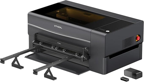
xTool S1 (20W Laser Cutter)
My main machine for all projects — reliable, quiet, and large enough for A2 work. The packaging and setup were excellent.
View on Amazon
Bosch PWB600 Workbench
Lives on my balcony all year in sun and rain. Folds flat for storage, very sturdy, and completely reliable.
View on Amazon
Measuring Tape (cm & inches)
Originally bought as a prop, but genuinely useful — clear markings and easy to read when working quickly.
View on Amazon
xTool SafetyPro AP2 Air Purifier
Essential for indoor laser work. Reliable and effective — I’ve learned it’s best to clean regularly rather than wait for a smoke-filled room.
View on Amazon
Kanpe Hapio Water-Based Spray Paint
Now my go-to paint. One thin coat is enough for route layers, and it dries evenly and quickly.
View on Amazon
Holts Car Paint (previously used)
Used in earlier maps due to convenience, but typically requires multiple coats — likely designed more for metal than wood.
View on Amazon
Konishi Wood Glue (Carpentry Bond)
I’ve had the same bottle for years. Only a thin, even layer is needed — very reliable.
View on Amazon

Completed map: La Coruña to Faro — full Portugal route. Photo by Mr Tim.
Water Layer
The water layer includes the Atlantic Ocean, Mediterranean Sea, rivers, and lakes. These areas are cut separately and later sprayed in blue tones.
The Atlantic Ocean is finished in a deep blue fading into a lighter foam blue along the coastline, a technique similar to the one I used on my Honolulu map.

Laser-cut water layer before painting. Coastal areas are prepared for gradient spray. Photo by Mr Tim.

Water layer drying. The Portuguese coastline becomes more defined as the paint settles. Photo by Mr Tim.
Land Layer
At this scale it would be impractical to include full contour lines, so instead mountainous regions are represented using engraved terrain shading.

Engraved terrain layer showing mountainous regions. Borders are lightly scored into the wood. Photo by Mr Tim.
Road Layer
The road layer shows the main arterial roads and expressways across Spain and Portugal.

Engraved elevation graph showing height and distance of the route. Photo by Mr Tim.
Route Layer
The cyclist’s journey is highlighted in orange, ensuring strong contrast against the wood layers.
- La Coruña
- Vigo
- Porto
- Coimbra
- Lisbon
- Faro

Orange cycling route layer, cut and ready for finishing. Photo by Mr Tim.

Road layer trimmed after cutting, before painting. Photo by Mr Tim.
Elevation Layer
A separate panel shows the elevation profile of the ride, reaching approximately 580 metres.

Elevation profile layer engraved and ready for finishing. Photo by Mr Tim.
Handcrafted Process

Trimming the elevation layer by hand prior to painting. Photo by Mr Tim.

Layers being bonded together using wood glue. Photo by Mr Tim.

Wooden pins engraved with flags to mark the start and finish points. Photo by Mr Tim.

Place names engraved across the route for clarity and detail. Photo by Mr Tim.

xTool S1 (20W) in my workshop setup. Photo by Mr Tim.

Removing the road layer from the laser bed. Internal lighting helps, with additional ring light for clarity. Photo by Mr Tim.
Why Layered Maps Work
Separating geographic features into individual layers allows the design to remain clean while still conveying complex information.
Water, terrain, roads, and the cycling route each have their own visual space, creating depth while keeping the map easy to read.
This layered approach transforms a long-distance cycling journey into a piece of display-ready wall art.
If you are interested in creating your own custom cycling map from a Strava activity or GPX file, feel free to get in touch.
Mr Tim
The Magic Crayons – Laser Cut Map Workshop